
- Product Knowledge
Laser Mapping Decoded: The Invisible Light Revolutionizing Our 3D Reality
The world is no longer flat—not in the eyes of laser mapping. This unassuming technology, powered by beams of light, has quietly become the backbone of modern innovation. From resurrecting lost civilizations to guiding robots on alien planets, laser mapping—or LiDAR (Light Detection and Ranging)—is rewriting the rules of perception. But what lies beneath its glowing surface? Let’s dive deeper.
The Anatomy of LiDAR: Photons, Precision, and Paradoxes
1. How LiDAR Works: A Symphony of Light and Time
At its essence, LiDAR is a stopwatch for light. A laser emitter fires ultrashort pulses (often infrared or green light) toward a target. Each photon races outward, collides with a surface—a leaf, a rock, a skyscraper—and ricochets back to a sensor. By calculating the time delay (tt) between emission and return, the system determines distance (dd) using the equation:
d=c×t2d=2c×t
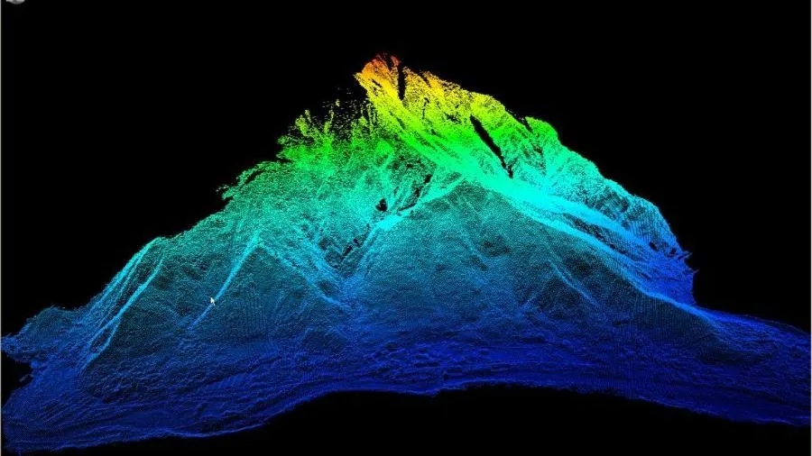
where cc is the speed of light. Repeat this process millions of times per second, and you amass a “point cloud”—a galaxy of data points that reconstructs 3D reality with sub-centimeter accuracy.
But here’s where complexity blooms:
Wavelength Matters: Green lasers (532 nm) penetrate water, mapping seabeds, while infrared (905–1550 nm) scatters less in air, ideal for aerial surveys.
Pulse Density: A high pulse rate (e.g., 1,000,000 pulses/second) captures fine details like tree branches or crumbling frescoes. Low density? Perfect for sweeping mountain ranges.
Return Signals: Advanced systems record multiple returns per pulse. The first bounce might hit a treetop; the last could reveal a buried Roman road.
2. Types of LiDAR: From Airborne to Quantum
Not all LiDAR is created equal. Key variants include:
Topographic LiDAR: Mounted on planes or drones, it maps land surfaces. Used in flood modeling and forestry.
Bathymetric LiDAR: Fires dual lasers (green + infrared) to chart underwater terrain. Critical for coastal erosion studies.
Geiger-mode LiDAR: Borrowing quantum physics, it detects single photons, excelling in low-light conditions (e.g., mapping caves or dense fog).
Solid-State LiDAR: No moving parts. Found in smartphones and self-driving cars for compact, affordable 3D sensing.
LiDAR in Action: Case Studies That Redefined Possibilities
1. Archaeology’s Quantum Leap
In 2018, a LiDAR survey of Guatemala’s Maya Biosphere Reserve unveiled 61,000 hidden structures—pyramids, farms, even defensive fortresses—under jungle canopies. The discovery suggested a Maya population of 10–15 million, triple previous estimates. How? LiDAR’s ability to “strip away” vegetation exposed ancient causeways and reservoirs, rewriting pre-Columbian history.
2. Climate Science: Measuring the Earth’s Pulse
NASA’s GEDI (Global Ecosystem Dynamics Investigation) uses spaceborne LiDAR to map forest biomass. By quantifying carbon stored in trees, it predicts wildfire risks and tracks deforestation’s impact on climate change. Over 20 billion laser shots later, GEDI has revealed that tropical forests absorb 1.4 billion metric tons of CO₂ annually—a lifeline for climate models.
3. Autonomous Vehicles: Seeing the Unseeable
Waymo’s self-driving cars rely on LiDAR to create real-time 3D maps. Unlike cameras, LiDAR isn’t blinded by darkness or glare. In 2023, a study showed LiDAR-equipped vehicles reduced collision rates by 40% in low-visibility conditions. But there’s a catch: snowflakes and raindrops can confuse sensors. Solution? Algorithms that distinguish falling snow from pedestrians.
4. Disaster Response: Saving Seconds, Saving Lives
When Hurricane Ian struck Florida in 2022, responders used pre-storm LiDAR maps to identify flood-prone zones. Post-disaster, drones with LiDAR scanned collapsed buildings, locating survivors via millimeter-scale shifts in rubble. Result? Rescue times slashed by 60%.
The LiDAR Dilemma: Technical Hurdles and Ethical Shadows
1. The Cost Conundrum
High-end LiDAR systems can cost $200,000—prohibitively expensive for small NGOs or researchers. However, startups like Velodyne and Ouster now offer solid-state LiDAR for under $1,000, democratizing access.
2. Environmental Interference
Rain and Fog: Water droplets scatter laser beams, creating “noise.” Solutions include polarization filters and machine learning that ignores transient particles.
Mirrored Surfaces: Glass skyscrapers or calm lakes can deflect lasers, generating phantom structures. Multi-sensor fusion (LiDAR + radar) mitigates this.
3. Privacy in a Mapped World
In 2021, activists protested Google’s LiDAR scans of European cities, fearing military or surveillance misuse. Regulations like the EU’s GDPR now require anonymization of 3D maps containing private properties.
The Future of LiDAR: Beyond 3D, Into the 4th Dimension
1. Quantum LiDAR: Seeing Through Walls
Researchers at MIT are developing quantum LiDAR using entangled photons. This could map objects hidden behind barriers (e.g., underground pipes) or detect tumors through tissue—revolutionizing medicine and espionage.
2. AI-Powered “Smart” Point Clouds
Traditional LiDAR data requires hours of human cleanup. Startups like Hivemapper now use AI to auto-classify points into categories (trees, cars, buildings), cutting processing time by 90%.
3. LiDAR for Biodiversity
In Kenya’s Tsavo National Park, LiDAR monitors elephant migration paths and detects poachers via subtle disturbances in vegetation—a non-invasive “eye in the sky.”
4. The Metaverse’s Backbone
Epic Games’ Unreal Engine 5 imports LiDAR-scanned landscapes to build hyper-realistic game worlds. Soon, virtual tourism may let you wander LiDAR-mapped versions of Machu Picchu or the Great Barrier Reef—all from your living room.